City of Hattiesburg · Review deadline April 13 · Eagles Flock, Leaf River
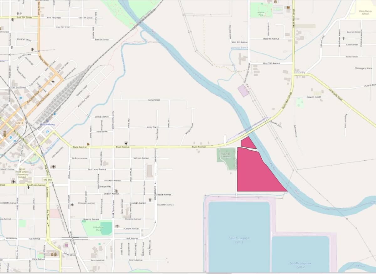
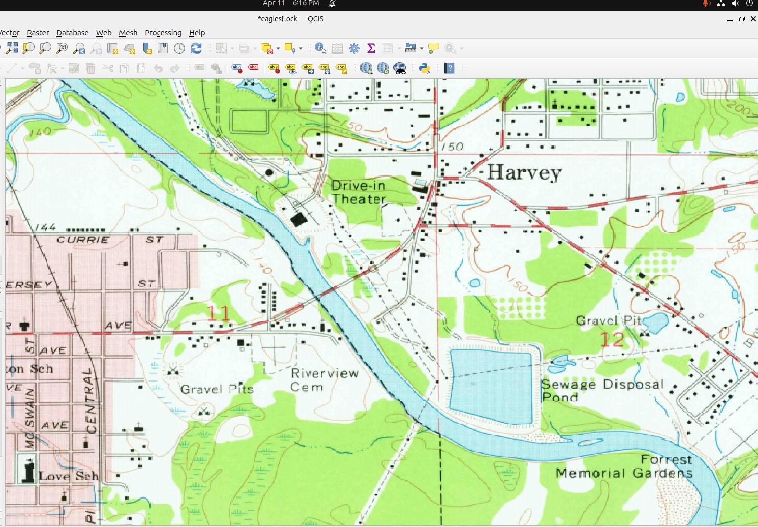
Close In, On the River. Eagles Flock sits on the Leaf River in East Hattiesburg off Old River Avenue — close to downtown and the Ward 2 fabric.
This material is submitted in support of the City of Hattiesburg’s pre-application review for the Eagles Flock site on the Leaf River.
The applicant is carrying two paths. These are alternatives, not phases — committing to one substantially forecloses the other.
Estate-lot-and-anchor path. A modest river-oriented anchor use on the north parcel, together with a limited number of large riverfront lots released gradually. The idea is to establish identity and value first, then let that support the lot sales.
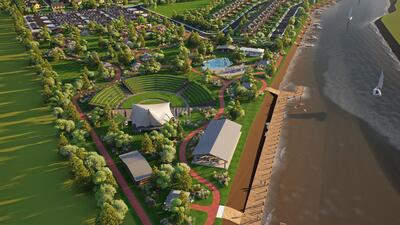
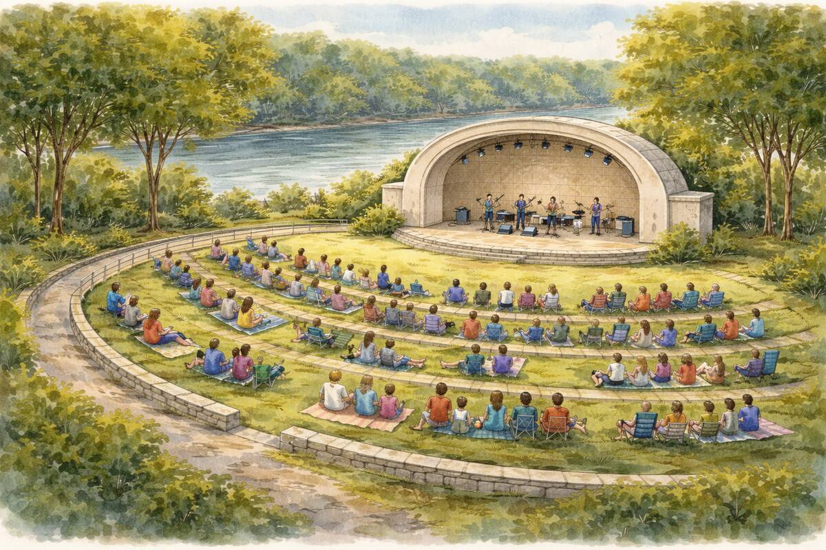
Workforce-housing-with-amenities path. Workforce housing as the core, with an approximately 8-acre riverfront park and related public-benefit elements — an amphitheater and marina elements. Horizontal investment for this direction is, at a reasonable order of magnitude, in the $3 million to $4 million range. An existing vehicle — the Leaf and Bouie River Development District, created by the State in 2020 — appears designed for infrastructure and park work of this kind. Without enough preliminary directional input, the applicant is not prepared to spend the engineering money required to push the workforce-housing path forward.
What we’re hoping to get from you all today is a practical read on which of these two directions, if either, the City may be comfortable with.
Five scenarios were filed. Two remain under active consideration. In both, the northern-parcel home proceeds first.
Northern-Parcel Home
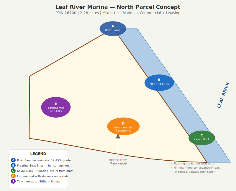
A single home on the northern parcel (PPIN 26700) is the first structure under either broader path. Parcel 1 contains approximately 1.93 acres per the EMS survey dated April 1, 2026, prepared by Christopher T. Johnson, PS 3129. A-1 zoning requires a 3-acre minimum, so the shortfall exceeds the 20% administrative adjustment threshold under LDC §2.4.3. The approval path appears to lie with the Board of Adjustment, with recommendation to City Council for final action under LDC §12.4.1.3. A recorded City of Hattiesburg maintenance easement (DB 567, PG 80) crosses Parcel 1 and affects approximately 0.36 acres.
It appears to the owners that this is a variance request under LDC §2.4.3 and §12.4.1.3.
Approval steps if processed by variance
Complete variance application filed with the Director of Urban Development
Published notice and property posting at least 15 days before the hearing under LDC §12.4.3.2
Board of Adjustment public hearing on the first Wednesday of the month at 3:30 p.m.
City Council consideration of the Board’s recommendation at the next 1st or 3rd Council cycle
Certificate of Zoning Compliance issued by the Director under LDC §2.2.1
Building plans submitted to Building Inspection for review under the IBC/IRC, energy code, and floodplain requirements
Pre-construction Flood Elevation Certificate and no-rise certification submitted
Building permit issued by the Director
The zoning and public-hearing portion of this process is estimated at 30 to 60 days from a complete variance application through Council action. Building Inspection review, floodplain documentation, and no-rise engineering proceed on separate timelines.
Owner’s View — Variance
Parcel 1 (±1.93 acres) is part of a larger tract of approximately 30 acres under common ownership. The owners see a variance as the appropriate mechanism to permit a single homesite on Parcel 1, consistent with the broader long-range plan for the tract.
Basis for the request
Government-imposed constraint. The City of Hattiesburg maintenance easement recorded at DB 567, PG 80 crosses Parcel 1 and affects approximately 0.36 acres, reducing usable area and limiting compliant lot configuration.
Natural boundary. Parcel 1 is bounded on the east by the west bank of the Leaf River. The irregular river boundary, together with floodplain constraints, narrows the practical buildable envelope. Expanding the parcel to satisfy the 3-acre minimum would impose a disproportionate burden on the remainder of the parent tract.
Pre-existing configuration. The parcel configuration reflects existing survey boundaries within the larger parent tract and predates this application. The hardship is inherent to the land.
Limited scope and compatibility. The request is for one homesite. No density increase. The proposed residential use is consistent with surrounding rural-residential patterns, and parcel-level setbacks, access via Old River Avenue and Lagoon Road, and utility service remain achievable.
Consistency with orderly development. The request allows limited residential use while preserving the natural character of the riverfront tract.
Request. Approval of a variance to permit one homesite on Parcel 1 within the larger parent tract.
Relationship to PMU-NB. A future PMU-NB rezoning could provide broader flexibility at the master-plan level on a longer timeline. The variance stands as a near-term path under current A-1 zoning and does not depend on any rezoning decision.
The practical difficulty is on the face of the record: a government easement, a river boundary, and a pre-existing parcel configuration.
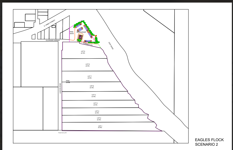
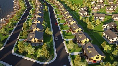
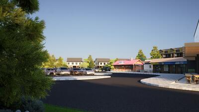
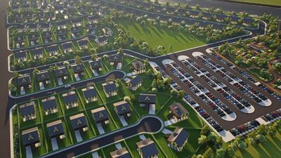
Estate-Lot-and-Anchor Path
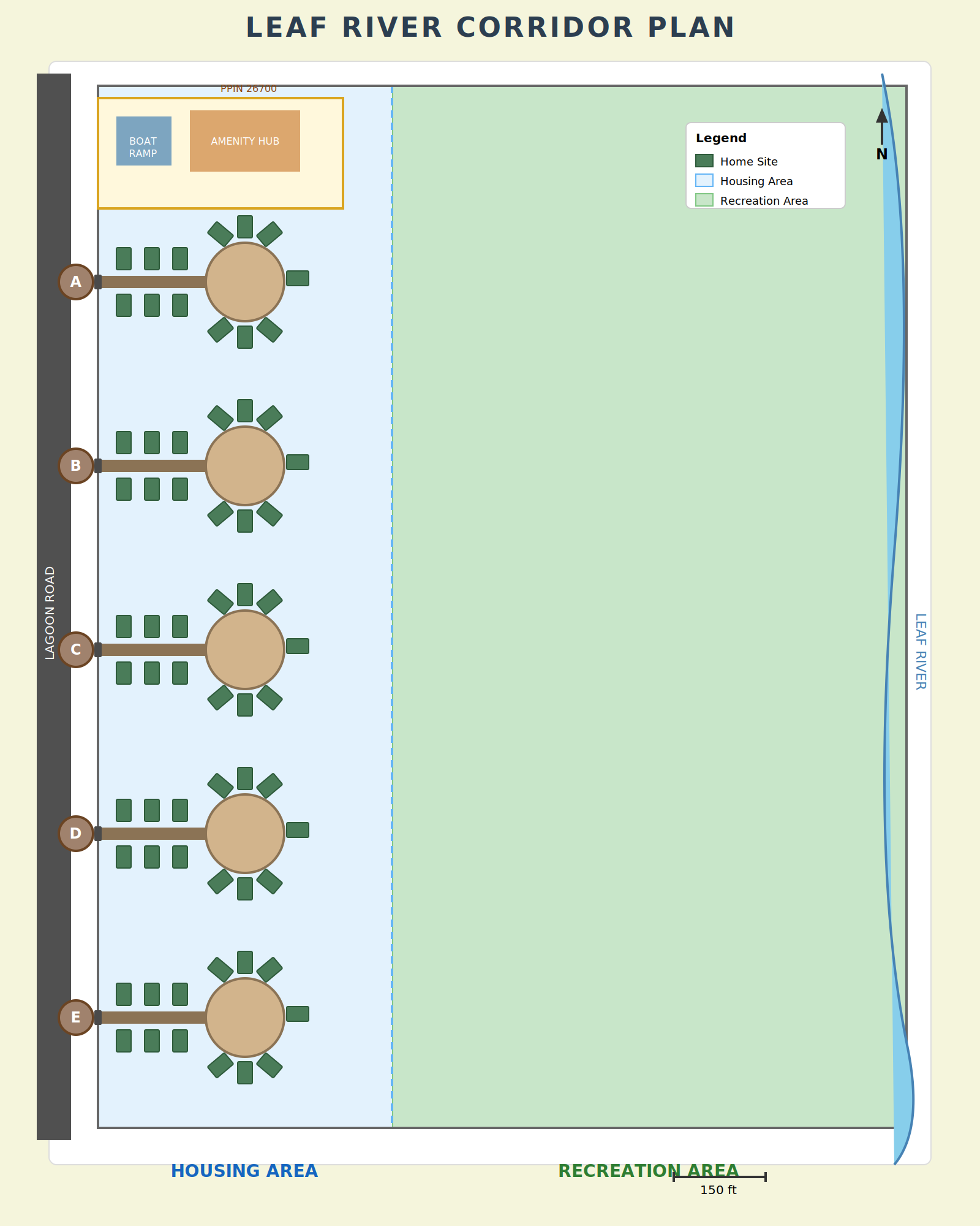
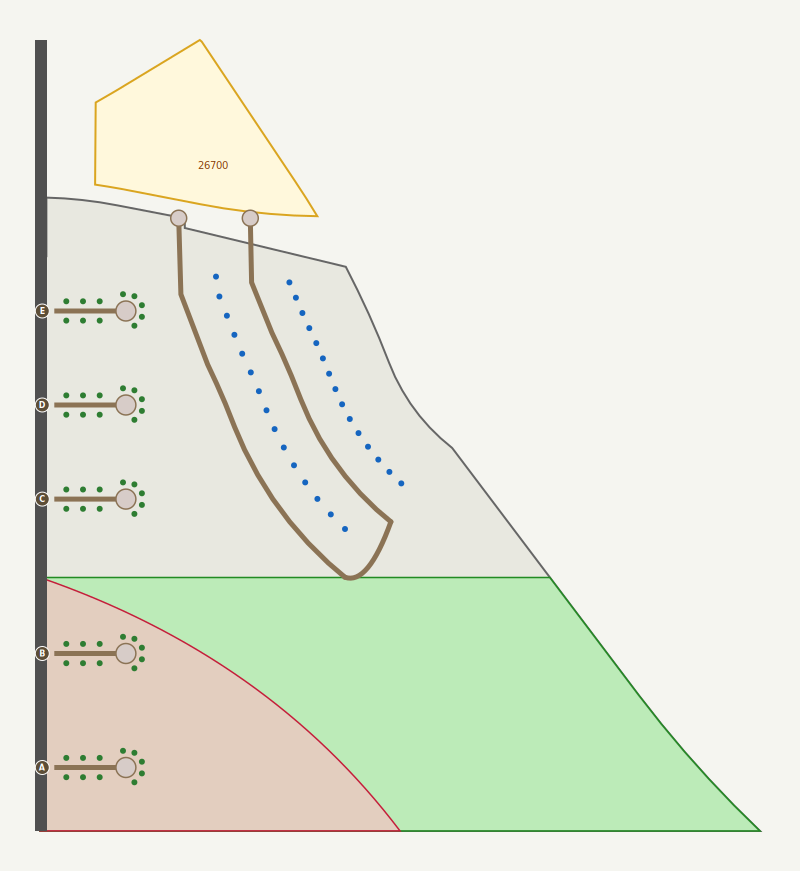
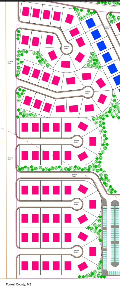
A river-oriented anchor structure on the north parcel and a limited number of large riverfront lots on the southern parcel, released in phases. Single-family detached use is permitted by right in A-1, so no rezoning is required. Any structure or recorded lot within the regulatory floodway requires no-rise certification.
Conceptual layout — north parcel anchor structure and southern riverfront lots.
Approval steps
Site Plan Review Committee review on the Thursday cycle following complete submittal
Preliminary plat review by the Planning Commission on the first Wednesday of the month
Final plat review by City Council on the 1st or 3rd Council cycle of the month
Estimated administrative timeline: 30 to 60 days from complete submittal to recorded final plat, depending on how the application aligns with the monthly meeting schedule.
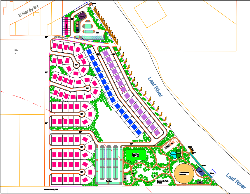
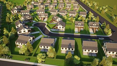
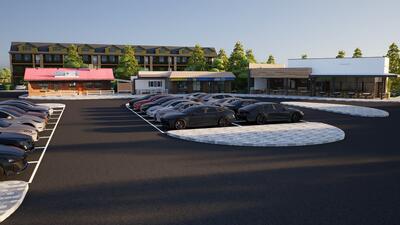
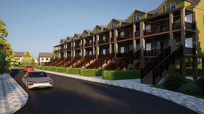
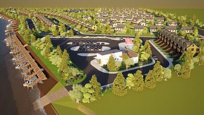
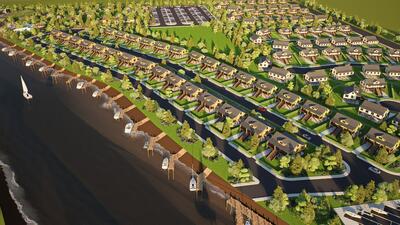
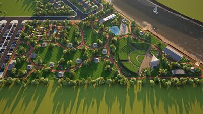
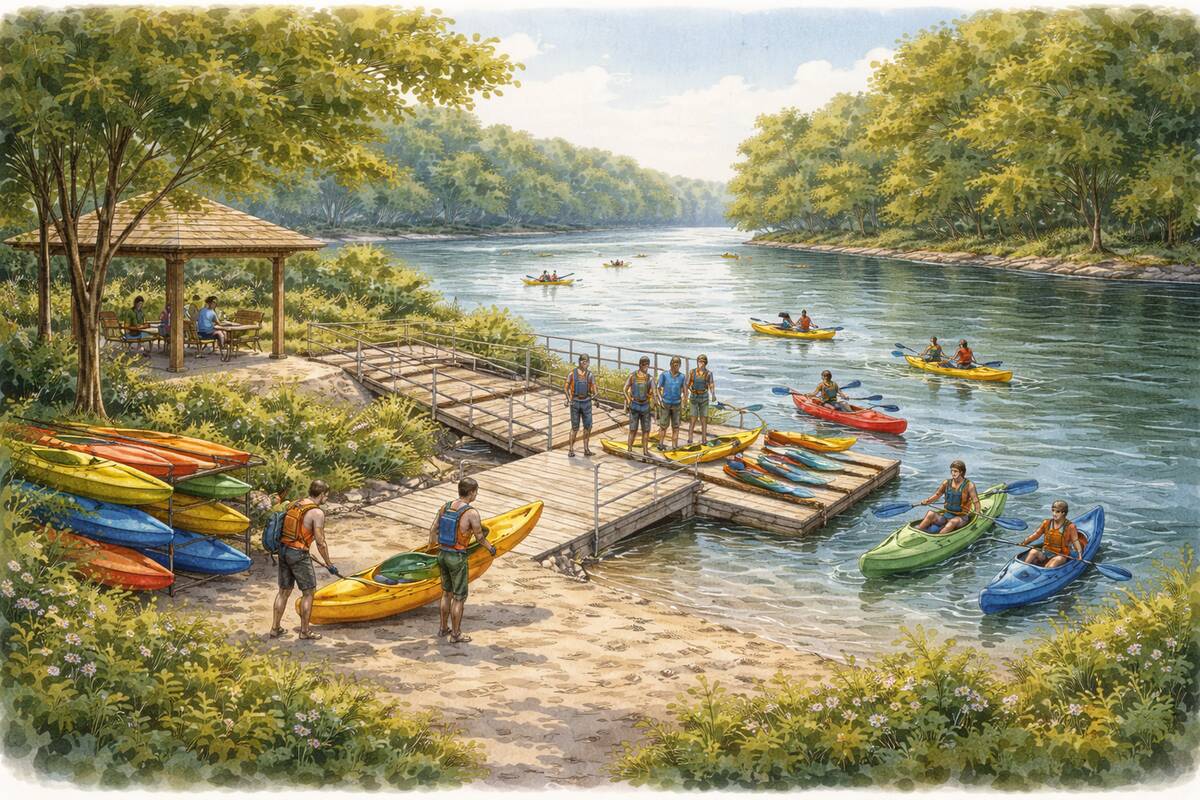
Workforce-Housing Path
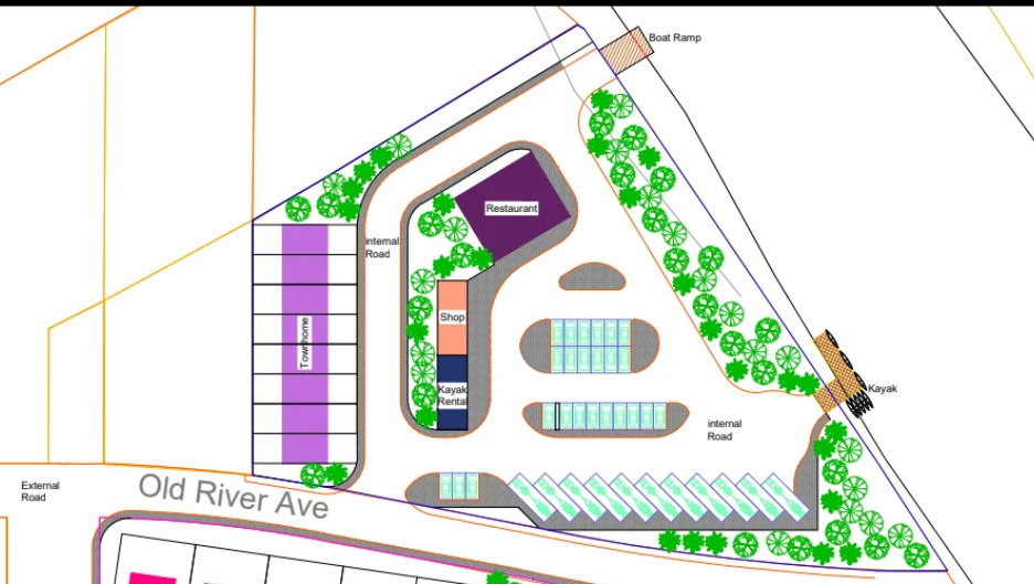
Workforce housing together with an approximately 8-acre riverfront park, a trail connection to the Pinebelt Blueways, an amphitheater, and marina-related elements. Aligns with the Neighborhood Business designation shown on the Future Land Use Map. Requires rezoning to PMU-NB (Planned Mixed-Use, Neighborhood Business). Under PMU-NB, rezoning is approved at the concept level and for the required mix of uses; detailed site configuration is reviewed later through the Site and Design Committee.
Conceptual full-vision site illustration. Final configuration subject to engineering, no-rise, and City feedback.
Approval steps
Application accepted by the Planning Division
Published notice at least 15 days before the hearing under Mississippi Code § 17-1-17
Planning Commission public hearing on the first Wednesday after the notice period
City Council public hearing and rezoning ordinance adoption one to two Council cycles after Planning Commission review
Site and Design Committee review of the configured site plan after rezoning becomes effective
Rezoning timeline estimated at 60 to 90 days from application acceptance through City Council adoption, uncontested. A Planning Commission tabling adds 30 days. Site and Design Committee review follows on the next Thursday cycle after rezoning.
Standing meeting cadence
Site Plan Review Committee — every Thursday, 9:00 a.m.
Planning Commission — first Wednesday of the month, 1:00 p.m.
Board of Adjustment — first Wednesday of the month, 3:30 p.m.
City Council — 1st and 3rd Monday (4:00 p.m.) and Tuesday (5:00 p.m.)
Filed scenarios on record
The five-scenario packet remains on file. Scenarios 2 and 5 correspond to the two live paths above; Scenarios 1, 3, and 4 are on file as fallback options.
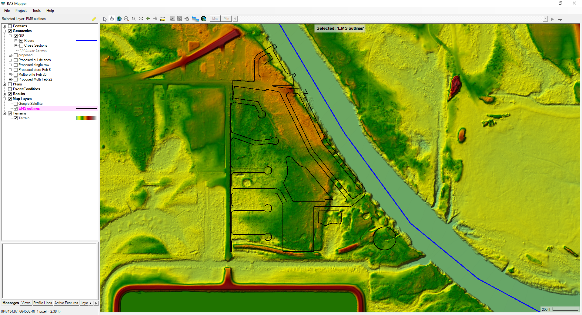
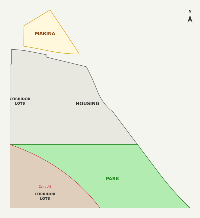
Most of the site sits in the regulatory floodway, with a portion in the southwest in Zone AE (flood fringe). Both overlays rule out conventional slab-on-grade subdivision construction. The applicant’s working concept uses a pier-plus-SIP approach for that reason.
Interim Hydraulic Status
Interim hydraulic review indicates 17 modeled cross sections, with 15 at zero rise and two park-area sections showing a small remaining issue that appears potentially addressable through layout refinement.
The interim report is on hand. Further hydraulic work is in progress.
Cross sections — 15 of 17 at zero riseLiDAR terrain — site elevationTopo with site overlay
Floodway and Flood-Fringe Treatment
The two overlays carry different requirements: the floodway portion calls for no-rise certification for any structure; the Zone AE portion can be built with standard elevation compliance. The applicant’s pier-plus-SIP approach is intended to address both.
Homes are elevated on piers, not built on slabs. The ground under each home stays open. Flood conveyance passes below the structure footprint. When the river rises, water flows under the elevated floor rather than against a foundation wall.
Structural Insulated Panels (SIP) are used for the walls and roof. SIP construction is tighter and more energy-efficient than conventional stick-frame, with lower utility load per home.
No slab-on-grade. No fill. No retaining structures.
Conventional subdivision construction displaces flood conveyance by placing slab foundations, bringing in fill to elevate pads, and using retaining structures. All three are prohibited by the floodway overlay. The pier-plus-SIP approach used here avoids each of them: piers replace slabs, elevation comes from the pier height rather than from fill, and the open ground under each home means no retaining structure is required.
The April 1, 2026 EMS plat updates the geometry: Parcel 1 = ±1.93 ac (smaller than the prior filing’s 2.28 ac); Parcel 2 = ±28.25 ac.
A City of Hattiesburg maintenance easement (DB 567, PG 80) affects ±0.36 ac of Parcel 1.
Does the north parcel support a single home under current A-1 and floodway conditions, and does the City maintenance easement (DB 567, PG 80) change that answer?
Any concern with a first-structure footprint designed so later low-intensity adaptive use is not foreclosed?
Historical USGS topographic mapping of the Leaf River corridor adjacent to the north parcel. Building symbols appear in the vicinity of the site.
Southern parcel
Plat-approval expectations for the riverfront lot subdivision on the southern parcel.
When the applicant first contacted Planning and Zoning in November 2025, Senior Planner Nathan Satcher advised that a project of this scope should come to the pre-application meeting with community support already in place. What follows is the record of that work to date.
Ward 2 · Councilman Eric Boney
Councilman Boney has been engaged on the project since February 2026. He has reviewed the site and supporting materials and has asked the applicant to deliver parallel work on Ward 2 priorities — Quality of Life framework, demographic analysis, community planning certificate program, and related research. That work has been delivered. Councilman Boney has set a meeting with Mayor Toby Barker on Wednesday, April 15 to discuss the project in advance of Thursday’s pre-application meeting.
Pinebelt Foundation
Initial call with Pinebelt Foundation staff on April 10 was encouraging. Staff independently brainstormed on possible support for park-related elements of the workforce-housing path. A follow-up call with Mike Dixon is scheduled for Monday, April 13. No commitment is in hand; the conversation is open.
University of Southern Mississippi
Contacts within the School of Ocean Science and Engineering have responded positively to the Leaf River expedition and research-vessel concept that forms part of the workforce-housing path.
Dr. Robert Leaf, Director, USM School of Ocean Science and Engineering — met with the applicant; provided administrative guidance on institutional involvement.
Dr. Zachary Darnell, Associate Director, Gulf Coast Research Laboratory — positive email exchange; referred the applicant to additional USM researchers.
Dr. Mike Andres, Gulf sturgeon researcher — positive response regarding the Leaf River corridor as a research site.
Workforce housing · hospital systems
Preliminary outreach to the two major Hattiesburg hospital systems began in January 2026 on the medical-staff housing angle that the workforce-housing path would address. The applicant paused that outreach pending the floodway interim result. Contacts:
Merit Health Wesley — Travis Sisson, Chief Nursing Officer.
Forrest County
The applicant has received positive feedback from the Forrest County Commission on the project’s concept and corridor alignment with county-supported riverfront work (Sims Road boat ramp, Pinebelt Blueways connectivity).
Project team
Chris Johnson, PE, PS — Engineering Manager, EMS (Hattiesburg). Engineer of Record. Civil, drainage, subdivision. Local; known to the City.
Interim hydraulic review was completed by Jill Butler, PE, CFM (River Science LLC, Kosciusko), who was originally referred by the City of Hattiesburg. Further hydraulic work is in progress.
Letters of intent · buyer interest
Beth Scharwath (RE/MAX Real Estate Partners) is the local real estate contact for the project. No buyer contracts or letters of intent are being collected at this stage.
The district framework referenced in the opening above is summarized below with source links and site-boundary verification.
Summary
Mississippi created the Leaf and Bouie River Development District in 2020 through House Bill 1649.
The law allows Hattiesburg, Petal, and Forrest County to work together inside the district.
It authorizes a minimum 15% diversion of ad valorem taxes collected within the district, with authority to contribute more.
Statutory framework — key provisions
Minimum 15% of ad valorem taxes collected within the district may be diverted to the district.
Member authorities have the option to contribute up to 100% of ad valorem, sales tax, or other taxes collected within the district, determined annually.
Proceeds are not general fund revenues.
Proceeds are dedicated solely to redevelopment of the district.
Allowed uses: recreation, infrastructure, planning, and other investments that enhance the economic viability and quality of life within the district.
Direct statutory text (Section 2, paragraph 3)
“The City of Hattiesburg, the City of Petal, and Forrest County is authorized, in their discretion, to divert a minimum of fifteen percent (15%) of ad valorem taxes collected from within the boundaries of the District with the option of contributing up to one hundred percent (100%) of ad valorem, sales tax or other taxes collected from within the boundaries of the District as determined annually by each member authority… Proceeds of the collections from within the boundaries of the District shall not be considered by each member authority as general fund revenues, but shall be dedicated solely for the purpose of the redevelopment of the District. These funds shall be used for the recreation, infrastructure, planning and other investments that enhance the economic viability and quality of life of those areas within the boundaries of the District.”
On today’s raw-land tax base, this mechanism is negligible. On a developed tax base, it would be materially larger.
Source: Mississippi House Bill 1649 (2020) — Leaf and Bouie River Development District, Section 2(3)(a)–(b). Referenced at p. 7, lines 157–169 of the enrolled text.
Illustrative District Capture — Today vs After Buildout
Current annual property tax (combined parcels)
$427.43
Current 15% district share
$64.11 / year
Post-development annual property tax
$489,916
15% district share
$73,487 / year
Increment over today
+$73,423 / year
Sensitivity — Capture Share
Capture %
Annual allocation
Approx. payback on $3,000,000
15%
$73,487
40.8 years
30%
$146,975
20.4 years
60%
$293,950
10.2 years
90%
$440,924
6.8 years
The figures above are illustrative. The current raw-land tax base is small; a developed tax base would be larger.
Figures shown are assumption-based and subject to final valuation, engineering, entitlement, public action, and legal review.
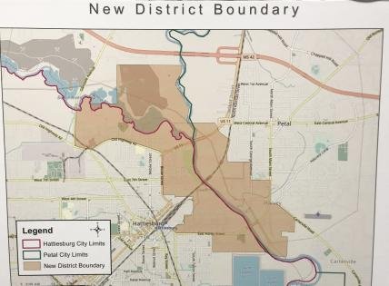
Both Eagles Flock parcels sit inside the Leaf and Bouie River Development District as defined in HB 1649 §3.
Published district boundary map (circulated by the cities of Hattiesburg and Petal; source: Hub City Spokes). Red-orange outline shows the New District Boundary covering both cities and adjacent Forrest County land.Site-level verification. Section 11, T4N R13W, Forrest County. Red line marks the district’s southern boundary as defined by HB 1649 §3 (“North Line of the S½ of the S½ of Section 11”). Pink shading is the district interior. Both Eagles Flock parcels lie north of the line.
PPIN 26700 (north parcel, 2.9 ac): approximately 1,370 ft north of the district’s southern boundary line in Section 11.
PPIN 26786 (south parcel, 28 ac): inside, with the southern edge approximately 90 ft north of the district’s southern boundary line.
Sources: parcel geometry from the City of Hattiesburg public parcels feature service; section geometry from the BLM National PLSS CadNSDI; boundary interpretation from HB 1649 §3 metes-and-bounds description. Quarter-section line derived by geometric quartering of the BLM section polygon.
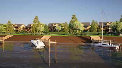
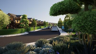
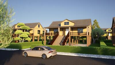
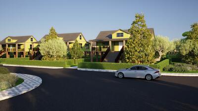
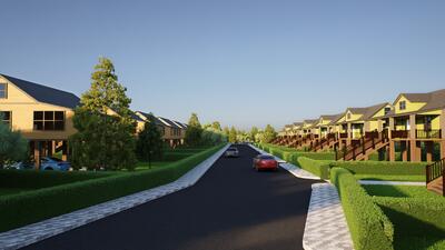
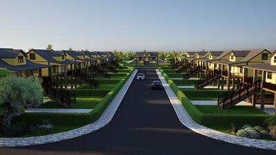
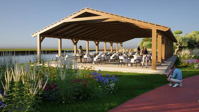
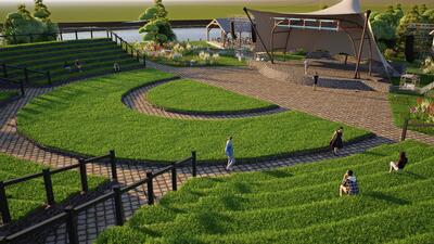
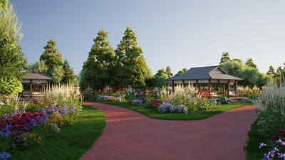
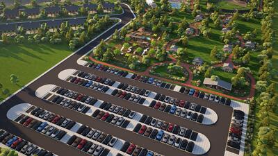
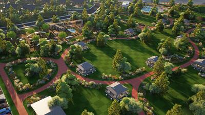
Fifty rendered scenes of the full-vision build-out (River Plant Vision v2). Shown for orientation; final configuration subject to engineering, no-rise certification, and City feedback.
Scene 1
Scene 2
Scene 3
Scene 4
Scene 5
Scene 6
Scene 7
Scene 8
Scene 9
Scene 10
Scene 11
Scene 12
Scene 13
Scene 14
Scene 15
Scene 16
Scene 17
Scene 18
Scene 19
Scene 20
Scene 21
Scene 22
Scene 23
Scene 24
Scene 25
Scene 26
Scene 27
Scene 28
Scene 29
Scene 30
Scene 31
Scene 32
Scene 33
Scene 34
Scene 35
Scene 36
Scene 37
Scene 38
Scene 39
Scene 40
Scene 41
Scene 42
Scene 43
Scene 44
Scene 45
Scene 46
Scene 47
Scene 48
Scene 49
Scene 50
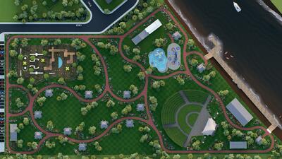
Engineering diagrams, site plans, plan views, and park concepts.
Location Map
Site Plan Synthesis
HEC-RAS Cross Sections
LiDAR Terrain Map
Topo with Site Overlay
Leaf River Corridor Plan
Site Plan (simplified)
River Roads & AE Boundary
Marina Plan (v3)
Housing Layout
Starter Homes
Marina Overview
Park Overview
Amphitheater
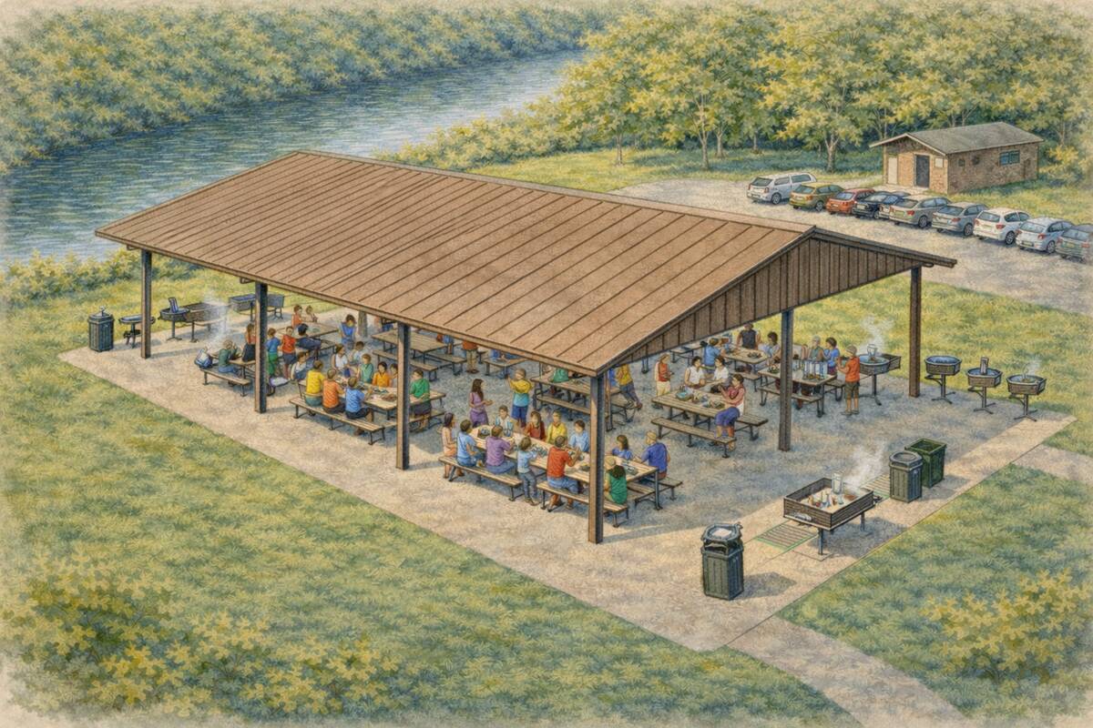
Pavilion
Kayak Launch
Swim Area
Playground
Reference material indexed for quick access.
City Fiscal Impact & Public Benefit Summary
Companion page. Recurring and one-time revenue estimates, ten-year fiscal range, grant-leverage logic, Qualified Census Tract context. Circulated to Councilman Eric Boney March 2026.
Site location map (Addendum G-2), parcel information (G-3), concept plans S1–S5, unit mix / floor plans (S4-B, S5-B, S5-C), community park concept (S5-D), marina concept (S5-E). Available on request; held in the pre-application packet.
Required documents
City pre-application checklist calls for a detailed concept plan drawn to scale, showing adjacent streets, property dimensions (County Parcel Map), site acreage, existing and proposed parking and structures with square footage, utilities and easements, and any subdividing of property.
Applicant materials on file with the City listed in Supporting Assets.
Our Team
Kent Batman
Partner · property owner Virtual
Local partner, parcel history.
Ricky Rayborn
Partner · property owner Virtual
Co-owner, site access, neighbor relationships.
Michael Hoffman
CEO, North Star Group
Developer.
Chris Johnson, PE, PS
Engineering Manager, EMS
Engineer of Record. Civil, drainage, subdivision.
Beth Scharwath
RE/MAX Real Estate Partners
Listing and transaction broker; local market intel.
City Leadership
Toby Barker
Mayor, City of Hattiesburg
Sets administration posture on development.
Ann Jones
Chief Administrative Officer
Operational gatekeeper; moves items across departments.
Wiley Quinn
Director, Urban Development
Owns permitting, planning, and code enforcement path.